
Mapping the World by Heart – World Geography – Year-long Course – 11 AM PT
$628.30
“I cannot thank you enough for this year with our son. He has absolutely LOVED learning with you. He has looked forward to each live session, and has been excited to share so many things he has learned throughout the year. Your class has certainly set his love for geography on fire….Having a solid knowledge of geography is so crucial for truly understanding history as well as current world events. This course has certainly broadened our son’s horizons in a multitude of ways.” ~Parent Pia R.
Enrollment
Available
Step 1: Register Your Student
Step 2: Enroll Your Registered Student
| Instructor | Dr. Kirsten Stein |
| Content Levels | Grades 6-7 • Middle School Grades 7-8 • Junior High |
| Course Length | 32 Weeks - Year-long |
| Live Webinars Held On | Tuesdays, 11:00 - 11:50 AM Pacific - 8/13/24 - 5/17/25 |
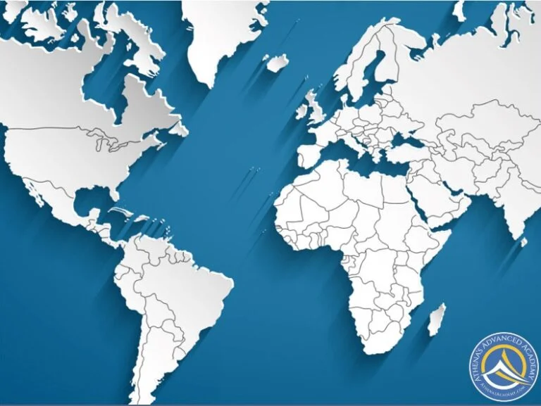
At Athena’s, our aim is for our students to become independent, confident adults who feel able to take on all that life throws at them. Our year-long World Geography course, designed for middle school/junior high level, plays a fundamental part in making this happen.
At the beginning, we set the seemingly overwhelming task of being able to draw a detailed map of the world by memory, and over the course of the year we work towards this.
Initially, we focus on map discovery, including thematic mapping, water bodies and continents. Then over the remainder of the fall and the spring semesters, we study the countries of the world. Our students will get the opportunity to share facts and stories about the countries that excite them through their own presentations to generate discussion and engagement.
By the end of the year, our students will be able to draw detailed world maps including borders, mountain ranges, rivers and major cities of more than 190 countries if they wish. We have found that there is a significant sense of achievement gained from completing a task, which may have initially seemed impossible. This invaluable learning increases self-confidence and creates a can-do attitude that will serve our students well in college and beyond.
Video Testimonials:
Note to parents:
- Students enrolled in this course and are interested in working on a group project are welcome to sign up for Dr. Kirsten’s supplementary Group Project asynchronous course.
What to expect in the Required section in the classroom each week:
Students are asked to complete map-related assignments during the week. Assignments include:
- Fall semester weeks 1-6 include at-home and online activities relating to the map theme or world feature.
- Fall semester weeks 7-16 include practice and drawing maps including continents, countries, and individual states.
- Spring semester includes practice and drawing maps including continents and countries.
- End of the fall through spring semesters, students may choose to create a presentation about a country we are studying.
What to expect in the Highly Suggested & Optional sections in the classroom each week:
- Curated resources, including websites & videos, are provided to excite learners and to add depth to the subject matter.
- Near the end of the first semester, students may create simple PowerPoint presentations to illustrate interesting facts about the countries we are studying. Students may share this information during weekly webinars. Participation opportunities depend on the number of students wishing to be involved from week to week.
What to expect during the weekly webinar:
- Weekly webinars are 50 minutes long. Webinars are recorded and are available for students with schedule conflicts.
- Primary instruction and guided discussions are provided during live webinars.
- Active Participation (via the microphone and chat) in online class discussions.
What to Expect During the School Year:
- Weeks 1-6 in the fall focus on map discovery including thematic mapping, water bodies, and continents.
- Weeks 7-16 in the fall focus on the North American and South American continents. During our time in North America, we will detail the 50 states in the U.S. and Canada’s provinces and territories.
- Weeks 17-32 in the spring focus on the European, Asian, African, and Australian/Oceania continents.
- The detail students put into their map-work is entirely up to the student and their parent.
Before taking this course, students should be able to:
- Read at a strong 6th grade level or above.
Students should be willing to:
- Actively participate (via the microphone) in the class discussion.
- Encourage class discussion by adding their questions/ideas in the chat window during the webinar.
- Respond with positive and encouraging comments on their classmates’ posts in the classroom forums.
To get the most out of this course, students should be able and willing to:
- Create at least one presentation about a country that we explore.
- Possess the skills and desire needed to draw an outline of a shape in order to create the outlines of states, countries, and continents.
- Complete the final project of mapping the world by heart.
Required books & materials:
- Mapping the World by Heart Map Set ($15.99). There is no need to purchase the Mapping the World by Heart binder. Besides the Map Set, all necessary information will be provided.
- To learn more about the curriculum, please visit the Mapping the World by Heart webpage.
- The curriculum was created for grades 5-12 to:
- Teach students to draw – entirely from memory – detailed world maps including the names, borders, mountain ranges, rivers, and major cities of more than 190 countries.
- Get students excited about geography and encourage them to think globally.
- Give students a constructive goal to work towards all year long. (mapping.com)
- Although the curriculum was created for grades 5-12, we focus on grades 6-8 in our course. Students are welcome to dive as deep as they desire into the different areas of the world.